861 Hits for February 2013
Albums (0) & Images (861)
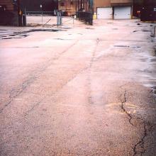
tb_cnw_elston_112609_1
This photo looks north from Fullerton Avenue between Damen Avenue and the Chicago River. You can see the curving tracks of this freight line buried under the asphalt. Ahead was the scrapyard to the right or east of the Vienna Beef factory. From period aerial photos it does not appear that Vienna Beef was ever rail served, and in fact, its plant is built over where this line would have crossed over Damen Avenue. The scrapyard was between Vienna Beef and the Chicago River.
According to the same 1956 directory the C&NW served the following companies in this area:
- Fathauser Company, 1880 -1900 Fullerton (hardwood lumber)
- Kingsbury Iron & Metal, 1900 W. Fullerton (scrap metals)
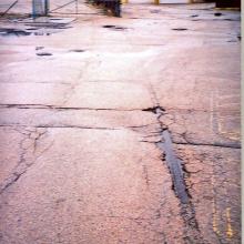
tb_cnw_elston_112609_2
Here’s a close-up of some of the rail reappearing from underneath the asphalt. The gate across the former ROW prevents further exploration.tb_cnw_elston_112609_2
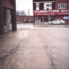
tb_cnw_elston_112609_3
The camera is turned the other direction now, towards the south and across Fullerton Avenue, showing the contours of the track. Until the 1990s the track was still visible where it crossed Fullerton. At one time there was a lumber yard in this area that was served by the C&NW.tb_cnw_elston_112609_3
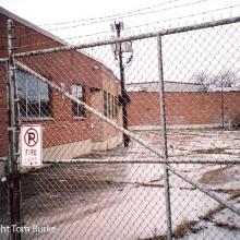
tb_cnw_elston_112609_4
Another gate prevents us from taking a closer look at where the track ran south of Fullerton but the curve of the building to the left is a clue as to where the line once ran.tb_cnw_elston_112609_4
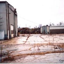
tb_cnw_elston_112609_5
This view looks east from Elston Avenue about one block south of Fullerton. The C&NW branch line is in the middle ground with the Chicago River in the background. It made a curve at this point to run parallel to Elston.tb_cnw_elston_112609_5
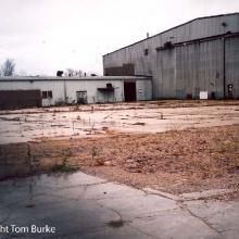
tb_cnw_elston_112609_6
The track continues its curve to the southwest to reach and parallel Elston by traveling across this empty parking lot. According to old maps and aerial photos this warehouse looking building was built long after the rail line was in place and was never itself rail-served though the main door looks big enough to accommodate rail cars. At one time this warehouse served as the offices of a UHF TV station in the 1980s. It was later used by the Chicago Sun-Times newspaper.tb_cnw_elston_112609_6
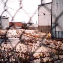
tb_cnw_elston_112609_7
The camara is looking north from the point at which the industrial track curved around the northwest corner of the building and began to parallel Elston. The way the tracks were embedded in concrete saved them from being salvaged long after they were abandoned.tb_cnw_elston_112609_7
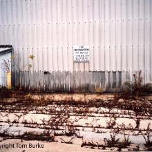
tb_cnw_elston_112609_8
A close-up of the tracks running between the warehouse type building and the sidewalk on Elston Avenue.tb_cnw_elston_112609_8
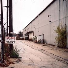
tb_cnw_elston_112609_9
This view looks north from a sidewalk along Elston. so the tracks are running in a northwest by southeast direction at this point,tb_cnw_elston_112609_9
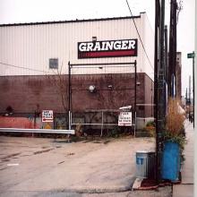
tb_cnw_elston_112609_10
We’re turned in the other direction now, looking southeast. A relatively new Grainger building is built on top of the former ROW as the tracks end abruptly at the building.tb_cnw_elston_112609_10
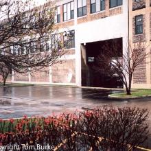
tb_cnw_elston_112609_11
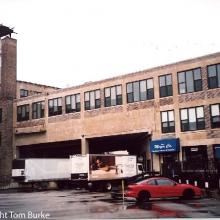
The tracks at one time went UNDER and THROUGH this building. The opening is still there though partly enclosed. This view looks southeast from Elston. The building through which it traveled is at the northeast corner of Elston and Webster.According to the same 1956 directory this line served the following customers at this location. Presumably the building it went under and through was The International Printing Ink Corporation. The Grainger building is about where the tannery would have been located.The International Printing Ink Corp2211 Elston
printers ink
Weil & Eisendrath
2221 N. Elston
tannery
tb_cnw_elston_112609_11
2211 Elston
printers ink
Weil & Eisendrath
2221 N. Elston
tannery
tb_cnw_elston_112609_12
Here’s a view of the same building from the other side looking northwest, showing where the tracks went under and through the building.tb_cnw_elston_112609_12
tb_cnw_elston_112609_13
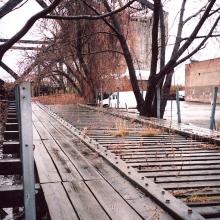
A wooden trestle in the heart of the city is a rare sight, and this one is remarkably well-preserved though the trails are long gone. The C&NW industrial line traveled up this wooden trestle to connect into the C&NW North Line just south of the Chicago River and over Webster Avenue. Behind us is the building that it went under. The difference in elevation between the trestle and the parking lot indicates that much of the ROW was bulldozed to create a flat parking lot sometime after rail service was discontinued.tb_cnw_elston_112609_13
tb_cnw_elston_112609_14
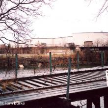
We’re looking across the C&NW trestle and the Chicago River to the other, eastern bank. The North Line bridge over the river is to the right or downstream. At a point roughly equal to the tip of the second, green handrail the Deering Line of the Milwaukee Road emerged from under the C&NW North Line. The City of Chicago white buildings to the right of the North Line were build over the former Deering Line ROW sometime after the Deering Line was cut back to Dominick Street after 1984.tb_cnw_elston_112609_14
tb_CPCarrollAve_1991_01
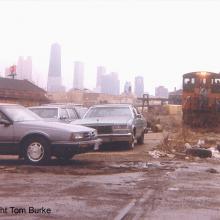
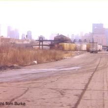
Chicago’s skyline is in the distance to the east as a CP Rail patrol switches out the remaining rail customers during a drab, early spring day in 1991. This job came from the former Milwaukee Road Galewood yard. An MP-15 still in Milwaukee Road colors is on the far right while its train is to the left. Prior to the end of CP Rail local freight service this far east on the former Milwaukee Road line in the mid 1990s crews alternated work between the C&E line on the North Side on Tuesdays, Thursdays, and Saturdays with Mondays, Wednesdays, and Fridays on this West Side line. This rail corridor just west of the Loop once featured local freight service by the C&NW, the Pennsylvania Railroad’s Panhandle Line, and the Milwaukee Road. The Pennsylvania Railroad ran as far east as Clinton St. with a curved freight house that survived up to 2004. It had a Braun Bottle sign on the roof that was visible to Metra commuters on the viaduct. A vestige of the Pennsylvania Railroad freight operation survives today under Norfolk Southern operation to serve the ADM milling plant.tb_CPCarrollAve_1991_01
