deeringHarvesterWorks_01
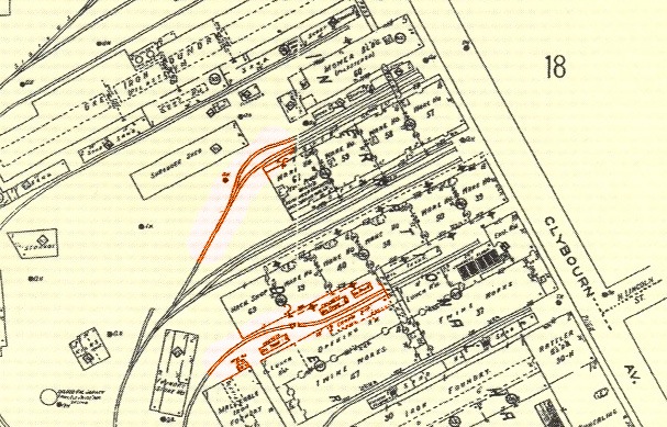
This historic map from 1923 shows the location of the spurs and the original names for the IH Deering Works buildings in the area. The tracks in red show the location of the spurs where the other photos were taken.
deeringHarvesterWorks_01
This historic map from 1923 shows the location of the spurs and the original names for the IH Deering Works buildings in the area. The tracks in red show the location of the spurs where the other photos were taken.
tb_mrha_deeringline_09_1980_01
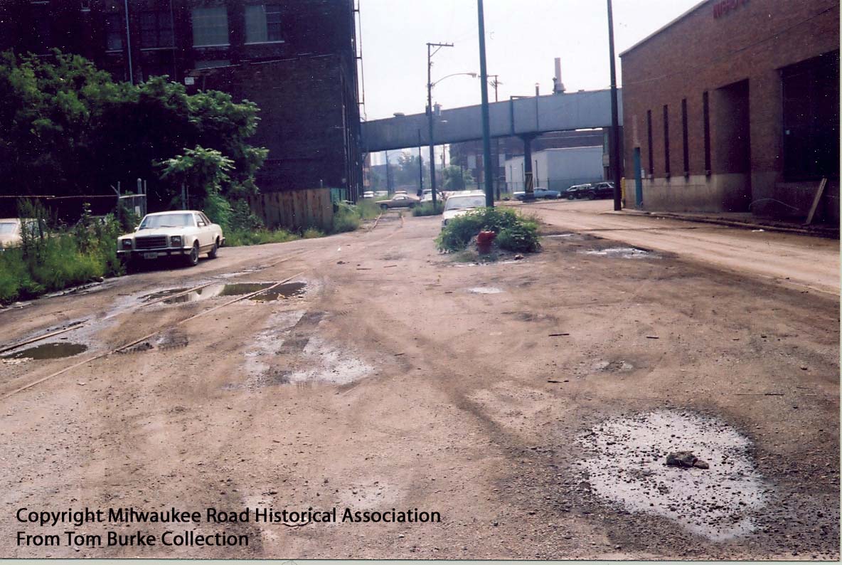
This view looks west by northwest along the Deering Line from a position just west of the underpass the Milwaukee Road used to dip below the C&NW North Line. To the left or south would be the North Branch of the Chicago River. A rail-served customer, Commercial Solvents, is ahead. This area was obliterated in the late 1980s and converted into a shopping center and parking lots.
tb_mrha_deeringline_09_1980_01
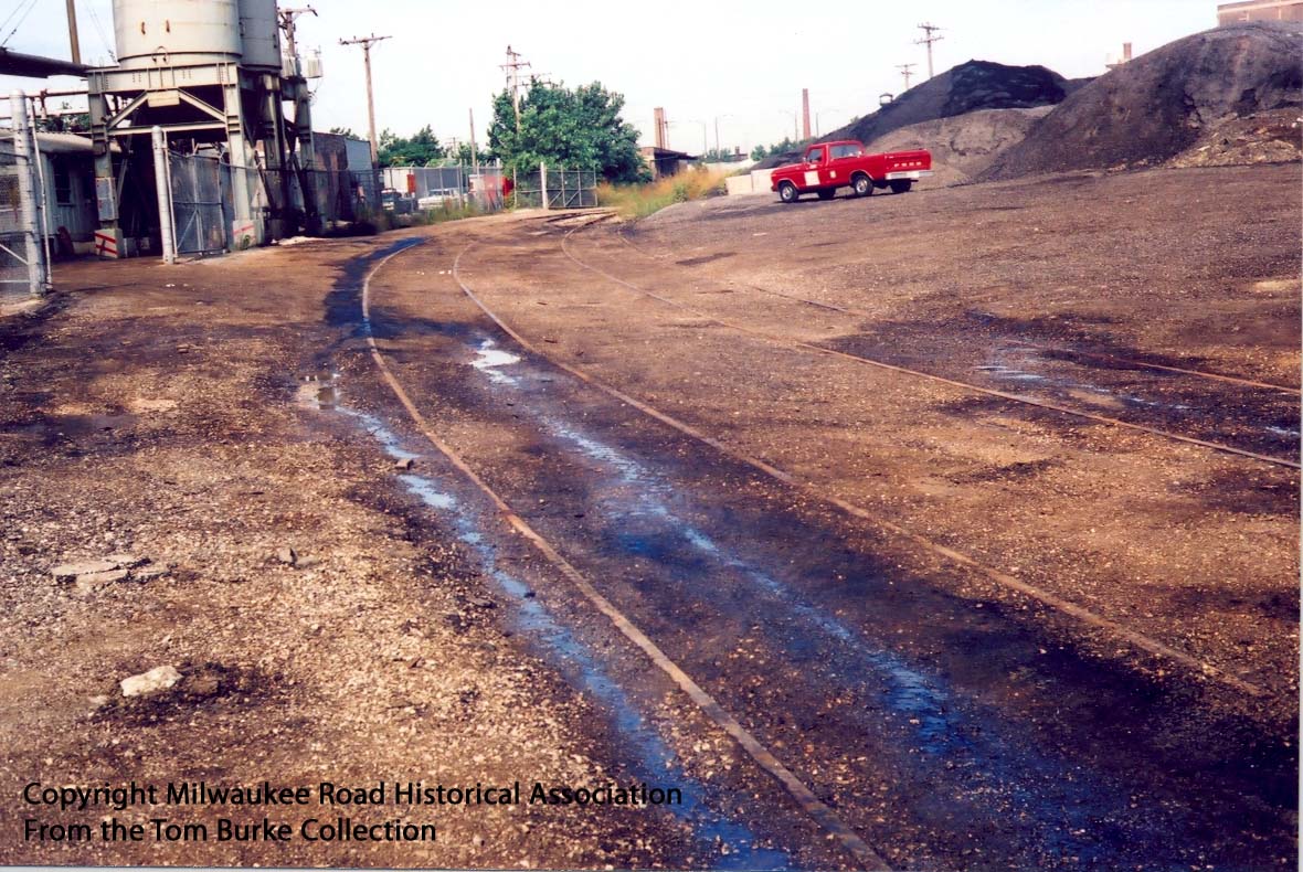
This view looks west by northwest along the Deering Line from a
position just west of the underpass the Milwaukee Road used to dip
below the C&NW North Line. To the left or south would be the
North Branch of the Chicago River. A rail-served customer,
Commercial Solvents, is ahead. This area was obliterated in the
late 1980s and converted into a shopping center and parking lots.
tb_mrha_deeringline_09_1980_02
We’re now looking west at the underpass below the C&NW North Line. This time the photographer is east of the underpass. Today this area is inaccessible and part of a City of Chicago facility. The tracks are long gone. Note the double tracks.
tb_mrha_deeringline_09_1980_02
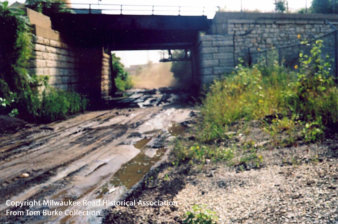
We’re now looking west at the underpass below the C&NW North
Line. This time the photographer is east of the underpass. Today
this area is inaccessible and part of a City of Chicago facility.
The tracks are long gone. Note the double tracks.
tb_mrha_deeringline_09_1980_03
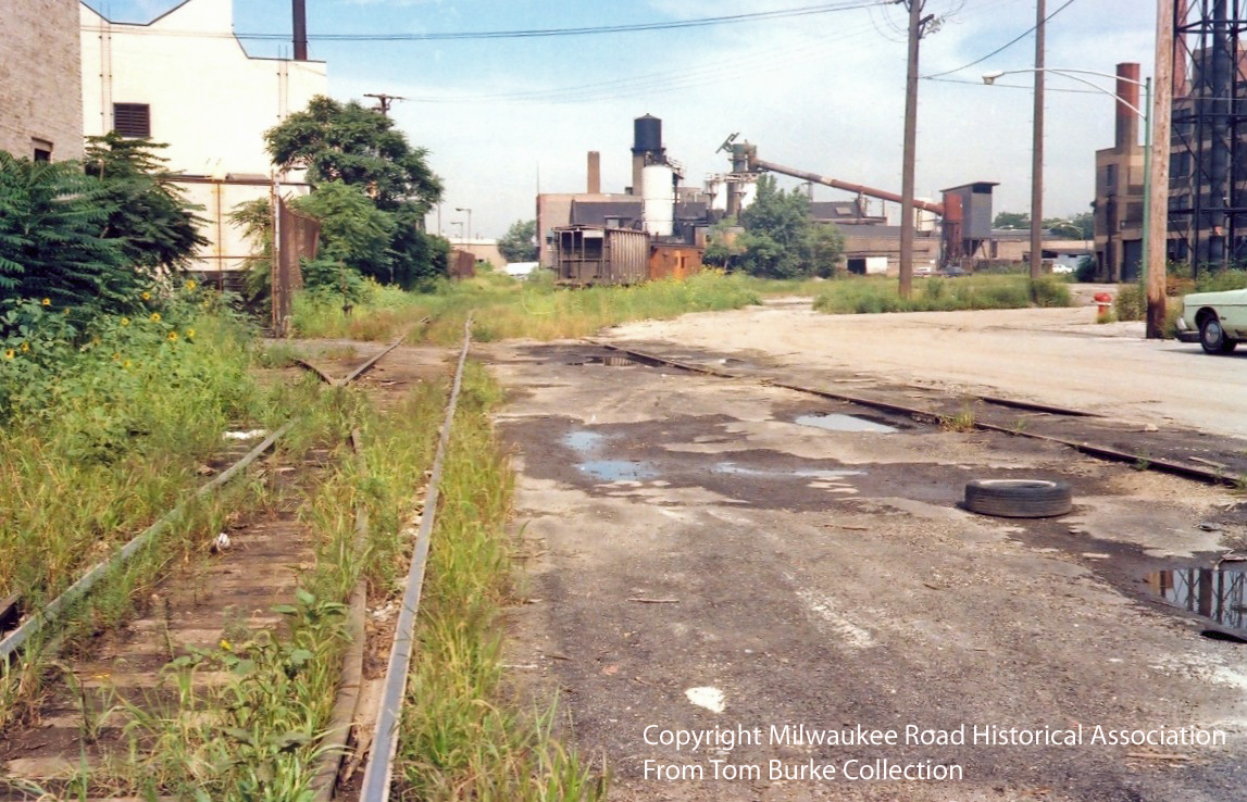
Perhaps the Milwaukee Road photographer wanted to highlight the poor conditions of the tracks on the Deering Line with this picture. They are there-buried in mud and oil.
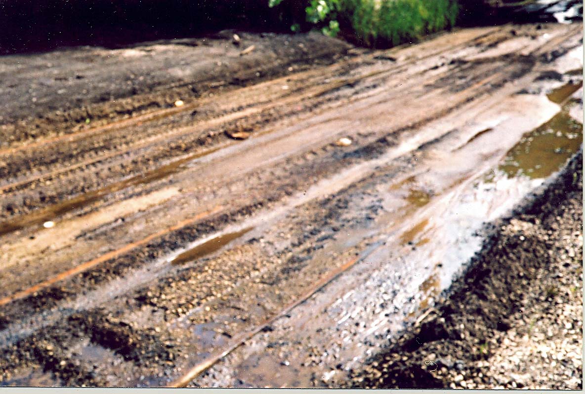
tb_mrha_deeringline_09_1980_03
Perhaps the Milwaukee Road photographer wanted to highlight the poor conditions of the tracks on the Deering Line with this picture. They are there-buried in mud and oil.
tb_mrha_deeringline_09_1980_04
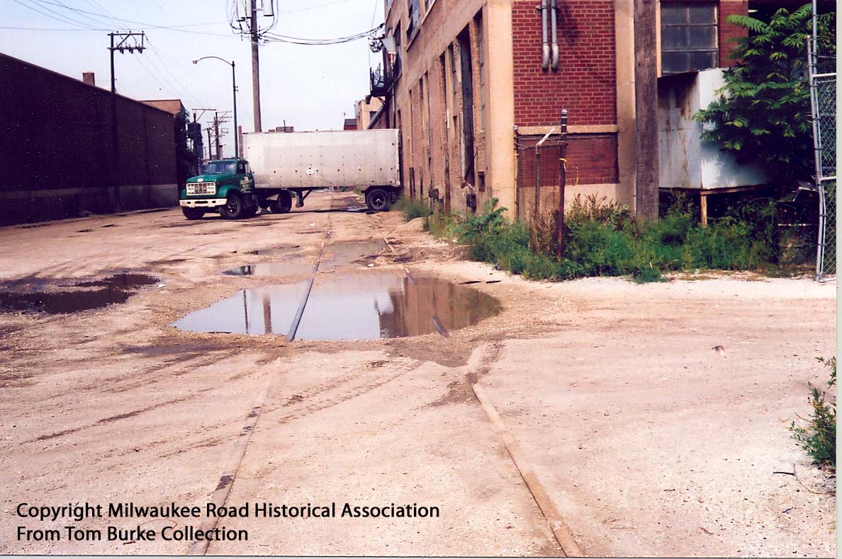
We’re inside the former International Harvester Deering Works north of Fulleron and west of Clybourn. This view looks south and towards the river. The spurs on either side serviced various buildings of the IH Deering Works which are occupied by other businesses in 1980. The building on the right looks relatively new however.
tb_mrha_deeringline_09_1980_04
We’re inside the former International Harvester Deering Works north of Fulleron and west of Clybourn. This view looks south and towards the river. The spurs on either side serviced various buildings of the IH Deering Works which are occupied by other businesses in 1980. The building on the right looks relatively new however.
tb_mrha_deeringline_09_1980_05
The camera is turned around the other way and faces north. Note how small truck trailers were in 1980 versus the behemoths used today.
tb_mrha_deeringline_09_1980_05
The camera is turned around the other way and faces north. Note how small truck trailers were in 1980 versus the behemoths used today.

tb_mrha_deeringline_09_1980_06.5
Looks like the expedition came across a relatively new looking boxcar sitting inside the Cotter & Company complex. It would be at the very end of the tracks inside the complex, near the intersection of Damen and Clybourn.
tb_mrha_deeringline_09_1980_06.5
Looks like the expedition came across a relatively new looking
boxcar sitting inside the Cotter & Company complex. It would be at
the very end of the tracks inside the complex, near the
intersection of Damen and Clybourn.
tb_mrha_deeringline_09_1980_06.25
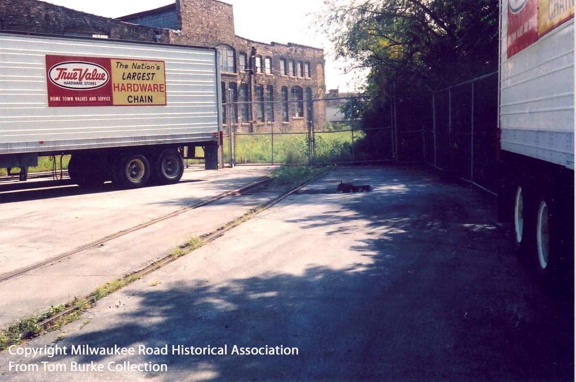
We’re in the depths of the Cotter & Company complex now that occupied most of the former IH Deering Works buildings. Note the True Value trailers stored here. See the accompanying map for details on the location of these spurs.
tb_mrha_deeringline_09_1980_06.25
We’re in the depths of the Cotter & Company complex now that
occupied most of the former IH Deering Works buildings. Note the
True Value trailers stored here. See the accompanying map for
details on the location of these spurs.
tb_mrha_deeringline_09_1980_08
Technically we are looking northwest along the C&E North Line on Kingsbury Street but this photo also shows the start of the Deering Line ahead in the distance. Note the caboose and covered hopper in the distance. Presumably the hopper is for Reed Candy, Continental Baking, or Peerless Confectionary farther up the C&E North Line.Just to the left of the hopper is the junction point between the C&E and Deering Lines. My guess is that a crew is working the Deering Line at this moment and left the rest of the train on the start of the C&E Line.
Note how Kingsbury Street was paved in dirt in 1980. That’s Finkl Steel to the left with one of its two spurs entering the property. This spur is still visible inside their fence in 2010 though no longer connected to the outside world since it was sliced off in 1985. This view looks northwest from about Cortland Avenue. In 1985 the City of Chicago would repave this section of Kingsbury and new trackage would set in concrete in the middle of the street with asphalt around the sides.
tb_mrha_deeringline_09_1980_08
Technically we are looking northwest along the C&E North Line
on Kingsbury Street but this photo also shows the start of the
Deering Line ahead in the distance. Note the caboose and covered
hopper in the distance. Presumably the hopper is for Reed Candy,
Continental Baking, or Peerless Confectionary farther up the
C&E North Line.
Just to the left of the hopper is the junction point between the C&E and Deering Lines. My guess is that a crew is working the Deering Line at this moment and left the rest of the train on the start of the C&E Line.
Note how Kingsbury Street was paved in dirt in 1980. That’s Finkl Steel to the left with one of its two spurs entering the property. This spur is still visible inside their fence in 2010 though no longer connected to the outside world since it was sliced off in 1985. This view looks northwest from about Cortland Avenue. In 1985 the City of Chicago would repave this section of Kingsbury and new trackage would set in concrete in the middle of the street with asphalt around the sides.